Normet SmartScan® combined with Normet sprayed concrete equipment provides a proven system to optimize the underground concrete spray application. Using 3D laser scanning technology, SmartScan eliminates the need for manual probing of the sprayed concrete thickness, significantly increasing the safety and efficiency of the concrete spraying process.
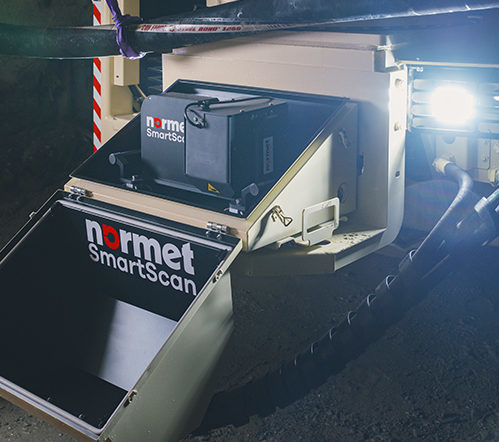
Normet SmartScan captures the applied layer thickness, allowing the operator to minimize excessive concrete consumption while ensuring that the required layer thickness for safe underground operations is achieved.
With a single touch of a button by the operator, the unique scanner and software package generates accurate point cloud data of the tunnel surface. The acquired data is then displayed in near real time on the onboard computer, in configurable colours for the respective layer thickness. The user interface is simple and easy to understand, and the 3D representation allows the measurement to be easily transferred to the underground application area.
Concrete thickness reports can be generated in-situ to document for each spray round or exported to common data formats for analysis later using SmartScan Desktop software or third-party software packages.
NORMET SMARTSCAN® ALIGN
Normet SmartScan® Align allows the transformation of the profile data into any coordinate system used in underground surveying. The georeferenced profile data enables data exchange with other equipment and systems, even after moving the concrete sprayer.
With the initiation of a new profile scan, the secondary LiDAR sensor installed on the concrete sprayer detects the targets attached to the tunnel walls that allow the transformation of profile data into the project's coordinate system.
The two scanners can be calibrated with minimal effort, thanks to a simple process and targets in the tunnel profile. This process is only required when the measuring devices have been detached or otherwise moved or ensure the systems are still well aligned.
KEY FEATURES SMARTSCAN ALIGN
- Automatic detection of retroreflective targets to georeference the profile data
- Export profile data in the coordinate systems used in underground surveying
- Simple process for system calibration and to ensure the systems are well aligned
KEY FEATURES SMARTSCAN LIVE ON-BOARD SOFTWARE
- Eliminates the need for manual probing of the sprayed concrete thickness
- Minimize concrete consumption while ensuring required layer thickness
- One-touch operation with a 3D representation of colored layer thickness
- As-built documentation and export in industrial data formats for later analysis
- No targets required for profile alignment

On-board software showing a single scanning complete.
KEY FEATURES SMARTSCAN DESKTOP SOFTWARE
- Advanced analysis of various scans and export to industrial data formats
- Quick generation of concrete thickness reports of spray rounds with customers' logo
- For long-term storage of raw and processed data

Desktop software showing a comparison scan result.